Map Elements
Chapter 11- Elements of Cartography
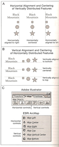
Alignment and centering are important in cartography
Map Elements
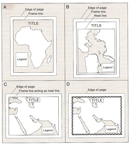
Neatline- may appear in a frame line (which contains all map contents) are used to limit map’s extent
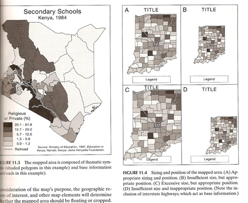
Mapped area- region of the earth being mapped
Thematic symbols relate to maps theme
Base information is a geographic frame of reference for the theme
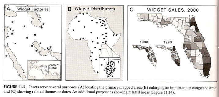
Inset- optional, 2 purposes
1. locator inset- show primary mapped area in relation to a more recognizable area
2. enlarge congested or important areas
3. to show topics that are related to map’s theme, could include photos, text or other maps.
4. to show areas that related to the mapped area
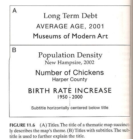
Title- clearly states the theme and what is being mapped
Legend- where map elements are defined (well defined legends and keys don’t need to be labeled “legend” or “key”) a better heading would explain the symbols (ei: percentage of college graduates)
Data Source- allows the map user to determine where the cartographer obtained their data
Scale- indicates the amount of reduction taken place (can be a fraction (1:2,400), verbal scale (one inch to 10 miles) or bar scale)
Orientation- indicates direction on the map, (a north arrow or gradicule)
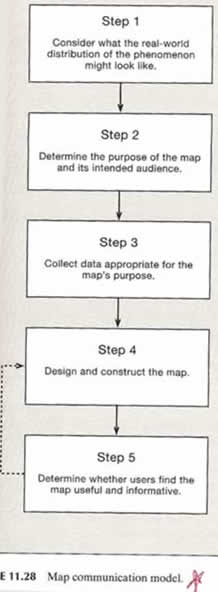
Cartographic Design- mental and physical design process, see the model below
Gestalt principles- describe the manner which humans see individual components of graphical images
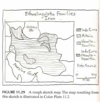
Design process
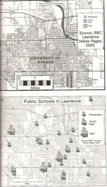
Visual hierarchy- symbols and map elements arranged according to their importance to the map’s theme A-bad example B- good example of showing visual hierarchy
Contrast- visual differences between map features
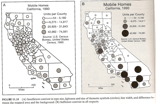
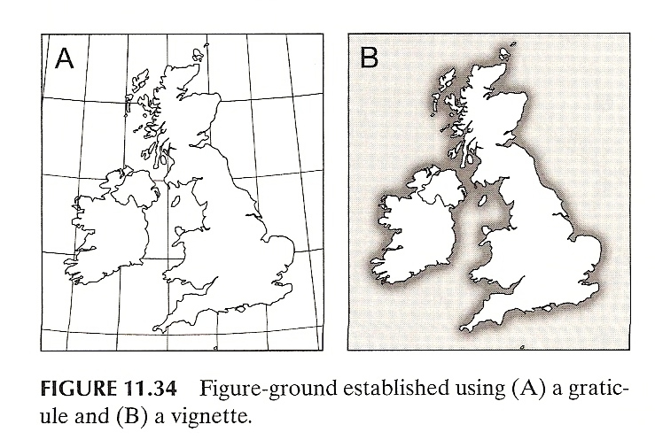
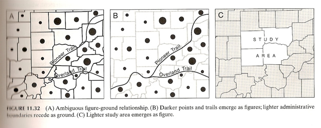
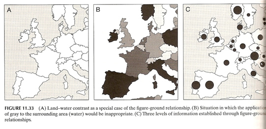
Figure-ground- accentuating object over others bester on perception
Screening- lightening
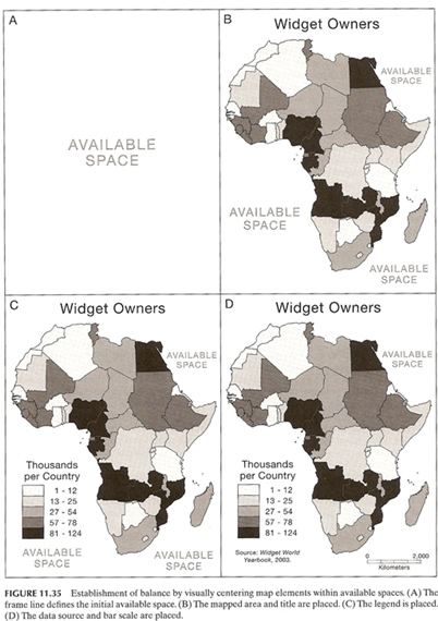
Balance- organizational relationship between empty (negative) space and map elements